Practiced in using GIS principles to provide solutions for communities meet modern sustainable development standards
How do we use GIS as a tool for urban planning projects?
GIS principles are perfectly positioned to lend themselves to the processeses involved with urban planning projects
The management and organization of the many different types of data that are involved with the planning process into one place where planners can easily search for them using spatial queries becomes a possibility. This database management sets a sturdy foundation for informing the decision making that will need to take place throughout the planning process.
This data can then be manipulated for a variety of purposes that are involved with the planning process. It can be used for spatial analysis purposes such as site suitability analysis. It can also be used to create visualizations in the form of maps or graphs to represent this data to end up with a clear vision of what is to be done throughout the life span of a project.
This map shows travel times using different forms of public transportation
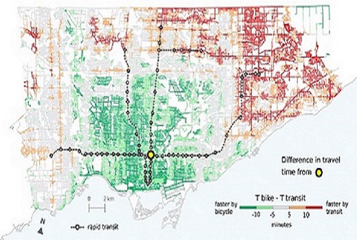
This map gives a clear visualization of this data and allows it to be integrated info design decisions made on community design projects
This map shows an example of differences in existing land use in a community
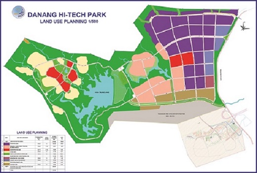
It shows an example of what can be replicated to clearly see the possibilities at sites under inspection