Forestry is an art and science that has been around for hundreds of years. While the desired outcome is the same, methodology and technology have evolved and GIS is now an integral part in forestry practices.
Digital Mapping
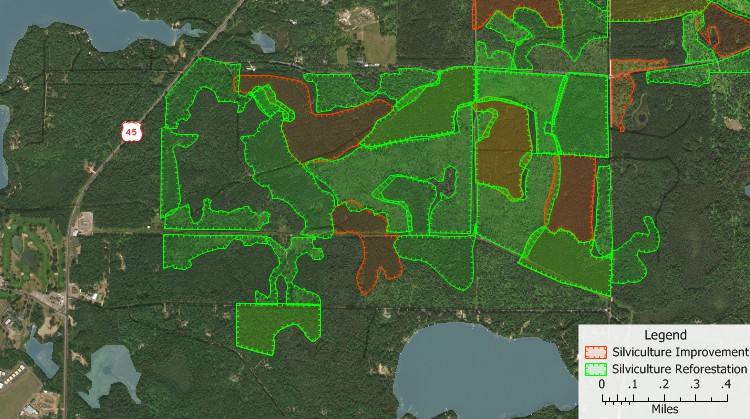
In the image above, we can see how mapping techniques were applied to show tracts of forest where there is Silvicultural Reforestation and where there needs to be improvement.
GIS can help with forestry practices through digital innovation. Some scenarios where GIS would be beneficial include:
- More efficient planning
- Increased accessibility for sharing management plans
- Modelling at risk stands (i.e. fire prevention)
Aerial Photography
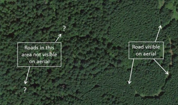
The image above is an example of an aerial photograph that could be used in a forestry setting. We can see how this image is able to pick up major roadways and help us to identify characteristics of this stand.
Aerial photography is a tool used to help prepare information and collect research forest professionals. Some examples include:
- Forest Inventory Data
- Monitoring of Forest Health and Natural Disturbances
- Forest Structure
Forests have been and will continue to be an extremely valuable resource for the world's populations. Not only in the tactile wood that is produced, but also by providing space for recreational activities for humans. Spending time in nature has been proven to improve the mental health and well-being in humans and because of this, forests are now more important than ever. GIS is a valuable tool that allows for forests to be seen, managed and monitored to be conserved and preserved for the many years to come.