Archaeology

Using GIS for site mapping and data analysis

Archaeology and GIS work hand in hand to allow us to view the spatial aspect of human behaviour.

A landscape view of a farmer's field, Ontario

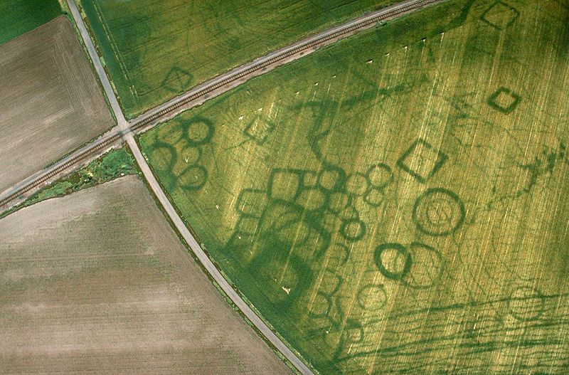
Archaeological Assessment

Here at SymbioGIS, we use predictive modeling to more accurately determine a location's potential for archaeological excavation. Our team is focused on analyzing an area with respect to its cultural, historical, and agricultural relevance, and producing archaeological sensitivity maps based on these qualities in conjunction with geospatial information. We also look at the impact of any future excavation and development on cultural land use, wildlife populations, and agricultural preservation.

Site Identification

Through the use of LiDAR and satelite imagery, possible locations of previous landmarks and buildings are identified. GIS helps us to analyze the areas in which sites are found to determine why and how the location was chosen and how it differs from contemporary finds. Differences in topography, hydrography, or animal populations likely influenced the historic decisions made when choosing a location - these datasets are used within our analysis to help determine area use within a greater archaeological overview study.

An aerial view of cropmarks at a protohistoric site at Grezac, France. Source: Wikipedia